The nearly 300-page report is the first waterfront plan since Superstorm Sandy, and comes at the end of a year in which the city was rocked by multiple severe weather events.
Adi Talwar
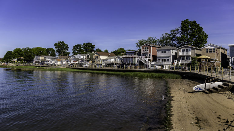
View of the Northern shoreline of Edgewater Park in the Bronx.A new city report offers a roadmap for tapping into New York City’s 520 miles of shoreline.
This week, the Department of City Planning (DCP) released its once-a-decade Comprehensive Waterfront Plan, outlining opportunities for the city to improve its coastline while boosting jobs, enhancing climate resilience and promoting environmental justice.
The nearly 300-page report is the first waterfront plan since Superstorm Sandy, and comes at the end of a year in which the city was rocked by multiple severe weather events. In 2021 alone, New Yorkers experienced blizzards that shut down the subway system, a summer of several record-breaking heat waves and in September, flash flooding that killed more than a dozen New Yorkers, many of them immigrants living in basement apartments.
“We just kind of scratched the surface of climate resiliency in the last comprehensive waterfront plan,” said Brendan Pillar, of DCP, in an interview with City Limits this summer. “And since Hurricane Sandy, now nine years later, New Yorkers’ attention on climate resiliency matters is much more heightened than ever.”
The agency released the plan in the last weeks of Mayor Bill de Blasio’s term, leaving the task of actually implementing the roadmap with incoming Mayor Eric Adams.
Adams has been vocal in his support for a greener city. In February, in his role as Brooklyn Borough President, he released a report promoting an agrarian economy for New York City, with a focus on youth education on urban agriculture. When running for mayor, he discussed a plan to invest in infrastructure along the waterfront with the city’s capital budget while promoting green jobs, and criticized lack of access to the shoreline from Robert Moses-era highways.
“We must not only build the infrastructure to protect our waterfront, we must continue to reactivate our working waterfront to create the green technology jobs of the future that will be integral to developing an economy that can reverse climate change,” Adams said.
Koenig Worrall, CEO and president of the advocacy group Waterfront Alliance, said the Waterfront Plan should be viewed as “a guiding vision for the incoming and future administrations.”
“This includes proposed solutions for addressing climate hazards, especially across vulnerable communities; realizing the potential of underutilized shorelines for recreation; and re-imagining the water’s edge as a place to work, live, and play while we work for its protection,” Koenig Worrall told City Limits.
DCP officials who worked on the report told City Limits their top priorities were addressing resiliency, access and economic growth. Following is a summary of the plan’s main points.
A resilient coastline, developing with floods in mind
In the report, DCP focused in part on climate adaptation and resilience, outlining specific goals the city could focus on to make the coastline better protected against climate change. These include increasing education, developing risk-informed land-use policies, focusing on resilient design and completing projects in the works since Superstorm Sandy in 2012.
Specifically, the report suggests implementing programs to retrofit buildings, developing with resiliency in mind in areas where future flooding can be managed and limiting residential development in high-risk waterfront areas where flood management is less likely in the future.
“It is also important to recognize that over time, climate change and sea level rise will make some areas unsuitable for residential use, and will result in the loss of some existing housing,” the report says. “Accommodating new housing at locations outside the flood zone, as well as at suitable locations within coastal areas, will be necessary to support the city’s long-term needs.”
Adi Talwar
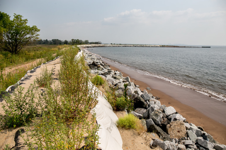
Reinforced dunes at edge of Oakwood Beach in Staten Island.A ‘just’ transition to new energy sources
The report notes a focus on seeking a “Just Transition,” in which communities who disproportionately bear the burden of the effects of climate change are empowered in the process of shifting toward renewable energy.
“A Just Transition relies on acknowledging past harms and traumas and creating new power relationships to facilitate a society-wide shift to a regenerative economy,” the report says.
It discusses community land trusts and a community-owned solar project as examples of how city agencies can enable New Yorkers disproportionately affected by the impact of climate change to benefit from a transition to renewable energy. It also highlights a collaboration with community leaders, including UPROSE, a nonprofit in Sunset Park.
“These projects aim to shift power and resources to environmental justice communities that have endured the lasting effects of urban renewal and fossil fuel-driven industrial pollution,” the report says. “Many of these same communities face growing threats from flooding and heat due to climate change.”
Waterfront access
The vision for climate justice outlined in the report will be further explored by the Mayor’s Office of Climate Resiliency, which is working on a Climate Adaptation Roadmap to be released next year, according to the office’s director, Jainey Bavishi.
“In the next 10 years the city’s waterfront policies and programs will be driven by the climate-justice principle that all New Yorkers should live, learn, work and play in safe, healthy, resilient and sustainable environments, even as the climate changes,” said Pillar.
Advocates and community organizers in environmental justice neighborhoods have long expressed frustration at the lack of access to the city’s coastline and water. In its recommendations for the report, the Waterfront Alliance suggested the city prioritize access to the water, including adding spaces that are accessible to individuals with disabilities.
It also noted the potential for the city’s maritime history to promote interest in the waterfront, and suggested the city improve access to public facilities near its coastlines. (Last month, a plan for a new boathouse in Sherman Creek Park in Inwood along the waterfront came under criticism for not including public restrooms.)
READ MORE: Public Bathroom Access at Heart of Dispute Over New Inwood Park Facility
Green economy
As New York ramps up its solar and offshore wind facilities, the city notes additional opportunities for jobs and economic growth. It suggests investments in waterfront hubs, including Hunts Point Food Distribution Center, Governors Island and Brooklyn Army Terminal, as well as using the expected-to-close Rikers Island for renewable energy.
DCP also recommended a focus on promoting jobs, including partnering with CUNY colleges to prepare students for offshore wind jobs and tapping into career centers to improve access to industrial jobs.
Building and upgrading infrastructure along the waterfront—including tunnels damaged by Superstorm Sandy or at risk of rising sea levels—is another focus to achieve this goal.
“We have a goal [with] all of this work, which is connecting the investment on the waterfront to the employment and career advancement opportunities for New Yorkers,” Lucrecia Montemayor of DCP told City LImits this summer, while the plan was in progress.
Liz Donovan is a Report for America corps member.




3 thoughts on “NYC’s Waterfront Plan Maps Out Next Decade for City’s Coastlines”
While Rikers island does have renewable energy potential, its ideal use would also include a massive sewage treatment plant for which there is almost no other feasible location and which is direly needed.
The 300 page report seems extremely vague…the largest opportunities on our waterfronts are new ferry landings but the report offers no plan or insight into their untapped potential. To most of us it is simple and obvious, build affordable housing adjacent to ferry landings.
DCP also recommended a focus on promoting jobs, including partnering with CUNY colleges to prepare students for offshore wind jobs and tapping into career centers to improve access to industrial jobs.