Adi Talwar
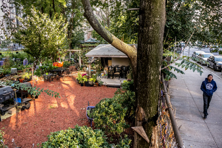
Chenchita's Community Garden is part of this street scene in East Harlem, one of several city neighborhoods where rezoning plans and deep housing vulnerability mix.
On Wednesday, the Association for Neighborhood Housing and Development (ANHD) released its annual data graphic documenting the risks to affordable housing in each of the city’s 59 community districts. These “risks” come in a variety of forms, including indicators that families are struggling to afford their rent, like rates of overcrowding and rent-burdening, as well as measures of how many existing affordable units are at risk of expiration, and other factors.
The graphic allows for a nuanced understanding of how the city’s affordability crisis manifests itself in different ways, depending on the borough, the phase of gentrification, and the housing stock.
For instance, several Manhattan neighborhoods received high rankings for potential loss of HUD-subsidized units and for the size of their rent-stabilized housing stock (which ANHD considers a threat, given the vulnerability of rent-stabilized housing to deregulation); In north and central Brooklyn, there’s been a sizable drop in the number of home purchase loans to low-income families. As for historically-impoverished regions of the Bronx, the affordability crisis looks like high rent burdens and homelessness—a sign that as Manhattan and even Brooklyn have become the province of the wealthy, the city’s “last bastion” of affordability is increasingly struggling to take in the rest of the city’s displaced. Notably, higher rates of overcrowding than the previous year were seen in neighborhoods across the board.
The graphic is also a useful starting point for examining the particular vulnerabilities of the neighborhoods that the de Blasio administration has targeted for rezonings.
Of the eleven neighborhoods that have approved or are considering a rezoning, four—Jerome Avenue, Southern Boulevard, East New York and Inwood—are among the top ten (out of 59 community districts) that have the most “threats to affordable housing” present.
As ANHD points out, the chart is not a fool-proof way of assessing what neighborhoods are at most risk of losing affordability, as the graph only considers a small sample of possible risk factors. If the graph considered percent change in average rent, average income and demographics since 1990, already-gentrifying neighborhoods like the Lower East Side and East Harlem would certainly look more at-risk. And the risks faced by residents of Gowanus and Bay Street are somewhat obscured by the large, wealthy homeowner populations encompassed in their community districts.
Still, ANHD’s Emily Goldstein says the graph “re-illustrates the point [that] it’s the neighborhoods with a lot of existing housing issues and risks, a lot of the high-risk neighborhoods, [that] are the ones under consideration for rezoning” while many neighborhoods that do not face any affordability risks are not being rezoned. (The neighborhoods without a single housing risk? Bayside in Queens, Sheepshead Bay in Brooklyn, and Mid and Southern Staten Island. Check out City Limits’ interviews with representatives from these neighborhoods about whether they’d accept a rezoning.)
The administration has argued that its rezonings, coupled with a variety of other investments, will actually help to address the housing instability in these neighborhoods, and that the alternative is taking no action and allowing existing housing pressures to continue displacing residents. But Goldstein says the big question is still whether the total package—of a rezoning plus other tools—will end up exacerbating or reducing the risks.
Here are five takeaways about affordability risks in the neighborhoods we follow at ZoneIn.org:
1. Four ZoneIn neighborhoods—parts of Southern Boulevard, Jerome Avenue, East New York, and Inwood—are among the top ten neighborhoods in the city with the most households using housing vouchers. East Harlem, Bay Street, and Far Rockaway are among the top 20. ANHD considers a high rate of voucher holders a threat because dependency on vouchers means residents could be vulnerable to federal budget cuts.
1. In 2016, Bushwick far outranked the rest of the city in the number of serious housing code violations, with one of every three units suffering a severe violation. Goldstein says that this high rate deserves further study, but notes that the neighborhood has a large stock of small, unregulated buildings. With most of the city’s affordability programs and protections geared toward multi-family buildings, it’s possible that tenants in this housing stock—as well as small-landlord owners—face the most difficulties correcting housing maintenance issues.
2. Of all New York City neighborhoods, Jerome and East New York are home to the most residents applying to live in shelters. The explanation is simple: If you’ve been priced out of East New York or Jerome, where can you go next?
3. East New York, the Lower East Side, and the Rockaways rank among the top ten neighborhoods with the most at-risk Mitchell Lama Units; southern Jerome Avenue and the Lower East Side rank among the top neighborhoods with expiring Low Income Housing Tax Credit (LIHTC) units; parts of Southern Boulevard, parts of Jerome, and East Harlem rank at the top for at-risk HUD units. Such statistics might be useful in determining what kinds of housing assistance each of these neighborhood will need to prevent a loss of exiting affordable units.
4. Despite the Bronx’s reputation as the last haven for affordability, ANHD’s metrics place the Jerome Avenue neighborhoods at the top of the charts, with the most housing risk factors in the city. It’s home to some of the city’s most severe rent burdening, overcrowding, and housing litigation rates (though the last could be a sign of strong tenant organizing). It also ranks among the highest for small-home foreclosures and tax delinquency.
Neighborhoods like East New York and Southern Boulevard also have some of the highest number of threatening factors, suggesting that the triple problem of rising rents, increased demand from renters displaced by elsewhere, and historical disinvestment makes for a perfect storm of housing instability in these neighborhoods.






One thought on “Data: Deep Housing Risks in Neighborhoods Facing Rezonings”
the poor are being moved around like cattle outta their homes in nyc. time to fight back all of us