“Addressing the remaining 60 percent of the waterfront that is hard and non-absorbent cannot be left to chance. The creation of a buffer there will require a comprehensive plan and revision of the zoning code to facilitate its implementation.”

Adi Talwar
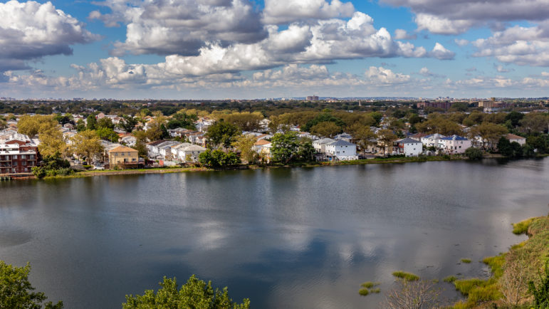
Waterfront housing is at risk working-class neighborhoods like Canarsie, the author writes.Since Hurricane Sandy in 2012, New York City has realized that its 520 miles of waterfront pose a hazard. But those 520 miles also represent a magnificent asset.
Like other 19th century port cities, such as Oslo, Barcelona and Genoa, New York slowly came to recognize that what had been for most of the 20th century blighted wharves were potentially both a defense against climate change and a glorious landscaped public space. In order to survive the seaborne threat of storm surges and a rising sea level, New York needs to fashion a buffer between what is built and what is water. That buffer will represent a new set of uses on property along the shoreline. To create a buffer, the entire city must play a role.
Before the advent of the Europeans, the shoreline was a buffer. The land was absorbent; plants slowed water flow and a general prevalence of softness muted the impact of storms. The Dutch, the English and then the Americans reversed all that. Docks, cribworks and breakwaters hardened the water’s edge and structures literally projected out into the rivers. Sandy demonstrated that the hardness strategy does not work.
The city was lucky, as it turned out. A great deal of the hardness at the water’s edge was for two endeavors that disappeared in the city during the 20th century: shipping and heavy industry. The insane competition between the region’s freight railroads prevented freight tunnels into New York City and necessitated the use of barges or car floats to move freight to the city’s docks. That inefficient system collapsed in mid-century with the rise of containerized shipping out of the New Jersey side of the Port of New York. During the same period, waterfront manufacturing left the city for large, one-story plants in regions served by trucking and the wide world served by containers. Much of the waterfront in the last quarter of the 20th century was simply abandoned.
Not entirely abandoned, however. Over the course of the 20th century the city embarked on a massive creation of parks, many along the waterfront. Of the 520 miles of city waterfront, 160 miles are in official city parks now. Another 60 miles are areas open to the public. Today over 40 percent of the waterfront is acting like an absorbent buffer.
The westside of Manhattan, especially from 59th Street north to Spuyten Duyvil, is an example. Jamaica Bay Park, an 18,000- acre wetland, the 85-acre Brooklyn Bridge Park and the new 2,200-acre Fresh Kills Park on Staten Island are mediating between the city and ocean. A significant amount of waterfront buffer is already in place. It no doubt needs to be improved but the tough part, getting control of the land, is accomplished.
This achievement was not according to plan, however. It was an accident of fate. The disappearance of shipping and waterfront industry along with park building had nothing to do with confronting climate change. Addressing the remaining 60 percent of the waterfront that is hard and non-absorbent cannot be left to chance. The creation of a buffer there will require a comprehensive plan and revision of the zoning code to facilitate its implementation.
A comprehensive waterfront plan would not be simple, but its basic concept would be to extend the buffer that already exists in the 40 percent of waterfront that is now parkland and public open space to the entirety of the waterfront. Unbuilt, planted land serves to mediate against both storm surges and rising sea level. Absorbent land can dissipate the energy of a surge and slow the creep of rising tides.
The difficulties in this quest are manifold. Many areas of the city are built-up hard to the very edge of the water and often even over the water, like the FDR Drive and the 207th Street Train Yard. Other areas are residential communities, often with occupied basements. South Brooklyn and Queens neighborhoods, like Canarsie, Manhattan Beach, Red Hook and Breezy Point, were heavily damaged by Sandy. These are not wealthy communities, but they represent the greatest challenge in the formation of a citywide buffer. Existing homes will need to be abandoned and replacement housing must be provided.
In those areas built hard to the water’s edge, infill creating a buffer between the water and city could offer some protection. The extension of Riverside Park out into the Hudson River to form the Henry Hudson Parkway was an infill project of 1937. Battery Park City is an absorbent infill at the edge of the rock-hard Financial District. Hudson River Park in Manhattan is not infill but is softening the edge between the river and the Westside Highway.
In other places levees, seawalls and raised ground levels can control water flow. East River Park, which runs under the Williamsburg Bridge, is currently being raised eight feet to resist surges. Floodgates designed to be moved into place to block storm surges are another infrastructure approach. During the Bloomberg administration a proposal was studied to build floodgates across the entrance to the Lower Bay from Sandy Hook in New Jersey to the Rockaways and across the East River at the mouth of the Long Island Sound. Its $119 billion cost doomed it.
The storm surge from Sandy in 2012 killed over 100 people in New York and New Jersey and caused $71 billion damage in the two states. Two Sandy-like storms would make the $119 billion look more reasonable. Floodgates in London and more recently in Venice have proven their effectiveness.
A current Army Corps of Engineers plan proposes 12 smaller floodgates and landform alterations for roughly $52 billion protecting harbor areas in New York and New Jersey. The map of its project locations, while not the entirety of the waterfront, marks a major advance in thinking comprehensively about the coast. Nevertheless, the fragmented locations of the work may make it less effective than a continuous treatment of the shoreline.
Finally, zoning for greater residential density has to be part of a waterfront plan. While the current zoning code has stipulations for building in flood zones, its emphasis on single and two- family residential districts in the outer boroughs less served by public transit restricts efforts to assist residents threatened by storm-driven flooding. The 1961 revision of the code reflected a suburban preference for low density housing in the outer boroughs. That land use attitude is a prime cause of the city’s current housing crisis.
To create absorbent land at the water’s edge many existing uses have to be removed. In the cases of existing residential neighborhoods, that is now very difficult. Removing houses in flood zones when there is little to no affordable housing alternatives is almost impossible. As in so many aspects of New York City today, lack of affordable housing is a fundamental obstacle to progress.
Federal funding for housing removal was established by the Obama administration after Sandy. Families will not move, however, even from dangerous locations, if there is nowhere to move to. The restrictions on higher density housing in the zoning code will have to be changed to permit the extension of the buffer and the creation of affordable, multi-storied housing in adjacent neighborhoods.
Interestingly, because of the linkage between the creation of waterfront buffer zones and the citywide need for greater housing density, the zoning aspect of the waterfront plan becomes paramount. To provide alternative affordable housing to waterfront residents in Queens and Brooklyn, for instance, means fundamental rezoning of residential neighborhoods throughout those boroughs to accommodate residents moved from the shoreline. To save the city from a climate change driven ocean, the entire city will need to be rezoned. Besides protecting the city, New York will be able to grow its population and become more productive. The waterfront plan then will be part of the vastly larger plan to spur the city’s growth.
With all 520 miles of waterfront buffering the built city from storm surges and rising sea levels, New York will have achieved a magnificent landscaped public amenity. New York’s coastal park system will be its identity and its savior. A rezoned city will not only be safer and more beautiful, it will have a far more powerful economy with its larger population. All of this is possible if the planning is comprehensive.
Charles Lauster is an architect in New York City whose firm does institutional work and public planning. He is currently finishing a book on infrastructure in New York during the 20th century.


2 thoughts on “Opinion: Buffering NYC’s Waterfront for Resiliency”
Hurricane Sandy was an extremely destructive and strong Atlantic hurricane, as well as the largest Atlantic hurricane on record as measured by diameter
Strong and devastating, Hurricane Sandy was the biggest Atlantic hurricane ever recorded in terms of diameter.