The 15-member NYC Districting Commission released a set of preliminary maps this month for the public to review, updating Council districts to reflect population changes based off the 2020 Census ahead of the City Council elections next year. See how would your current City Council district change under the proposal.
NYC Districting Commission
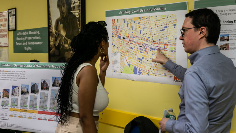
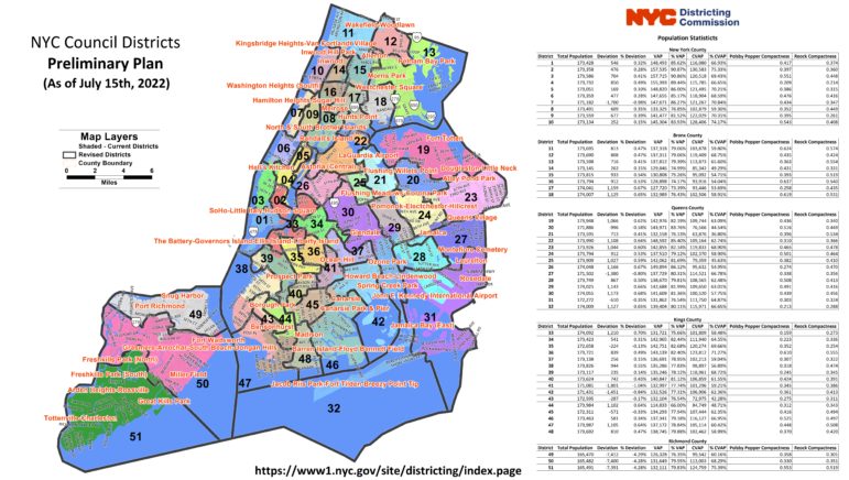
Preliminary maps of new City Council district boundaries released by the city’s Districting Commission.
It’s redistricting season in New York—again.
After a contentious process earlier this year to redraw the district maps for Congress, State Senate and State Assembly, New York City is carrying out its own redistricting process to create new boundaries for its 51 City Council districts.
The 15-member NYC Districting Commission released a set of preliminary maps this month for the public to review, updating Council districts to reflect population changes based off the 2020 Census, which saw the number of residents living in New York City grow from 8.2 to 8.8 million during the previous decade. The average number of residents per Council district will increase from 160,710 to 172,882 people under the new maps.
The Commission will hold a series of public hearings in August to gather feedback on the proposed new boundaries, which—if approved—will be in place for the 2023 City Council elections. Among the major changes in the preliminary plan is the creation of a new Asian-majority district in South Brooklyn, expanding the 38th district into Bay Ridge while dropping Red Hook to the north. Doing so would create a district where 57 percent of the voting-age population is Asian, according to the commission.
But current District 38 Councilwoman Alexa Avilés and Bay Ridge Councilman Justin Brannan—whose 43rd District would change significantly under the proposal, shifting north—criticized the redrawn lines for dividing Latino communities in Sunset Park and Red Hook.
“By combining our current districts 38 and 43, you are dividing our districts and further diluting the power we have to advocate for community-specific, shared needs and goals,” both lawmakers said in a joint statement.
Other criticism came from the New York Immigration Coalition, which said the proposed maps would split up “communities of color in Woodside, Ridgewood, Kensington and Richmond Hill.” A coalition of three other advocacy organizations representing New Yorkers of color have also drafted their own Council lines, calling it the “Unity Map,” which would, among other things, keep Sunset Park intact within District 38 as well as extend Staten Island’s District 49 into Dyker Heights.
How would your current City Council district change under these proposals? The Center for Urban Research at the CUNY Graduate Center has created a set of interactive digital maps, as part of their Redistricting and You project, which allows users to compare the current Council district boundaries to the new ones proposed by both the city’s Districting Commission and the Unity Map Coalition.
Choose a Council district from the drop-down box on the left, then use the slider tool at the top of the map to toggle back and forth between the current district lines and the proposed ones. You can also see how certain population demographics, such as race and ethnicity, would be changed by the new lines compared to the existing ones (the maps also include a breakdown of how each district, current and proposed, voted during the 2021 mayoral election).