Jerome Avenue Rezoning Environmental Impact Statement
The de Blasio administration’s proposed Jerome Avenue rezoning is currently in the final stages of public review, with a City Council hearing scheduled for Wednesday February 7. Many community residents remain concerned about the proposal, though the plan did receive the backing of the three affected community boards and Borough President Ruben Diaz, albeit conditioned on a list of changes to the plan.
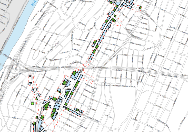
The proposal would allow increased residential and commercial development along an avenue in the western Bronx that is known today as an auto-business corridor, with a portion of the housing required to be income-targeted under the city’s mandatory inclusionary housing policy.
When confronted with concerns that mandatory inclusionary housing fails to create enough income-targeted housing that is actually affordable to local residents, the Department of City Planning (DCP) usually argues that because the real-estate market in the Jerome Avenue area is still weak, developers will, in the foreseeable future, seek to work with the city to build subsidized, income-targeted housing, resulting in more affordable housing than is required by the mandatory inclusionary policy.
“…A substantial amount of new residential units that are expected to developed within the rezoning area over the next 10 years would be affordable, and in the foreseeable future would likely be 100 percent affordable,” says the Jerome Avenue Environmental Impact Statement executive summary, and in another section, “In the foreseeable future, after the rezoning goes into effect, the construction of multi-family housing is still projected to be infeasible without government subsidy, to which affordability requirements would be attached.”
The administration offered a similar justification to residents of East New York and Downtown Far Rockaway, where city agencies also said the local market was still weak.
But just how long is the “foreseeable future,” and what exactly does it mean that a “substantial amount” of new units would be affordable over ten years?
DCP doesn’t pretend to know the answers. Asked to define “foreseeable future,” the agency said it was a time period in which the city can have some idea of what will happen, especially based on commitments from agencies like the Department of Housing Preservation and Development (HPD), which provides subsidies for affordable housing development. The timeframe could differ from neighborhood to neighborhood and program to program.
But the agency’s Environmental Impact Statement Appendix J does include a list of sites the city expects will be developed and how many market-rate and affordable units might be built on each. The city emphasizes that it’s not a precise prediction of what will be built on each site, and isn’t actually based on conversations with developers. Rather, it’s just one potential scenario, based off knowledge of market conditions and the area’s development history, that the city uses for the purpose of analyzing the rezoning’s possible environmental impacts.
Appendix J, which includes the latest analysis following the city’s adoption of an expanded rezoning area, includes a list of 48 sites that the city believes are most likely to be redeveloped within a 10-year time frame (the city also names another 107 sites that it believes have a lesser potential to be developed in that period). Of those 48 sites, the city assumes that some will be redeveloped with 100 percent, some with 50 percent income-targeted housing and some with 20 percent income-targeted housing. The last category—20 percent—is the least amount possible under the city’s mandatory inclusionary housing policy, and is an indication that the city does believe that, over a 10-year period, some owners might forgo subsidy agreements and instead build 80 percent market-rate buildings.
Overall, the city assumes that in 10 years after the rezoning, 57 percent of the total housing that is built will be income targeted and 43 percent market-rate. But some of that building would occur anyway, Looking just at what would occur because of the rezoning, the EIS assumes 70 percent of that housing would be income-targeted and 30 percent market-rate.
Asked to explain how the analysis was conducted, DCP explained that the city relied on assumptions about the market and factors that were likely to influence future income levels and rents, not on knowledge about specific development proposals. Indeed, a City Limits analysis found some of the development site scenarios seem to be more informed than others.
Services for the Undeserved, a nonprofit affordable housing developer, last year publicly requested that the city expand the rezoning to their property at 1600 Macombs Road so they could create about 400 supportive housing units. The rezoning was expanded to accommodate the request, and the appendix list lists 1600 Macombs Road as likely to provide about 400 units of income-targeted housing in the event of a rezoning.
The assumptions for a vacant property on Edward L Grant Highway are far less accurate. The city describes that without a rezoning, the owner, ELG Holding LLC, may build 13 market-rate apartments, and that in the event of a rezoning, ELG Holding LLC would still build 13 apartments, including affordable ones.
In any event, that’s not the plan for the site: ELG Holding LLC’s Kami Yaghoobian told City Limits that he was going ahead with construction in advance of the rezoning, and planned to build a 29-story apartment building in which he would make 30 percent of the units income-targeted in order to get a 421a tax abatement. It’s not the first time City Limits has reported a clearly erroneous assumption in an Environmental Impact Statement.
Every time the city prepares an Environmental Impact Statement for a neighborhood rezoning, the city prepares a list of development sites and potential development scenarios for those sites, but it doesn’t always include an analysis of the proportion of units that can be expected to be affordable. Such an analysis was included in the Environmental Impact Statement for East New York, which assumed that in 10 years 50 percent of the total new housing (or 54 percent of the housing that would occur just because of the rezoning) would be income-targeted.
Critics say that the city’s manual to analyze potential future environmental impacts and project future development is riddled with problems, including that it doesn’t consider rent-stabilized housing subject to redevelopment pressures even though past rezonings have been followed by the demolition of rent-stabilized buildings. That omission, such critics argue, depresses the number of sites likely to be redeveloped and masks the potential loss of affordable housing triggered by a rezoning. There’s also concern that the analysis doesn’t take into account the potential for a rezoning to hasten changes in the market, shortening the time frame in which developers still rely on city subsidies.
The City Council will host a hearing on the Jerome Avenue rezoning on Wednesday February 7, 9:30 a.m. at City Hall.


One thought on “The Ambiguous Game of Assessing Affordability in a Rezoning”
Pingback: With De Blasio Rezonings, City’s Scarce Industrial Land Becomes Scarcer - Make the Road New York : Make the Road New York