Adi Talwar
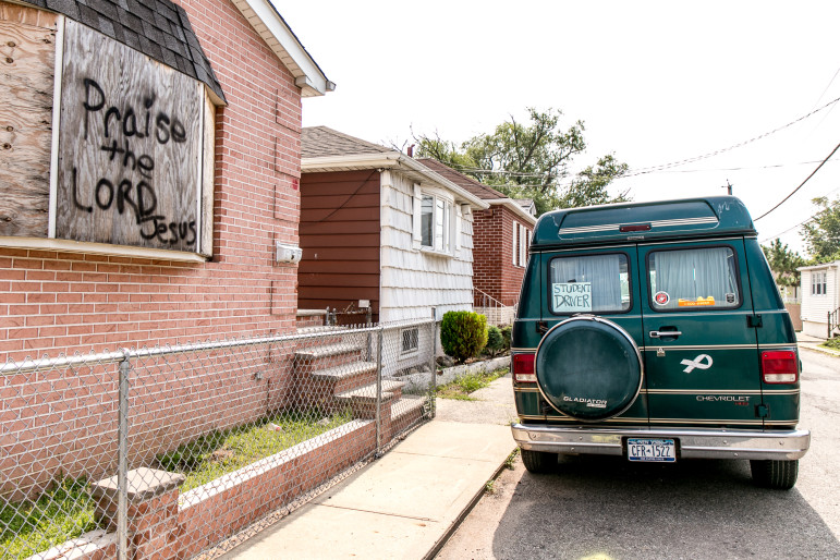
A property in Oakwood Beach, one of the few areas where a post-Sandy policy of retreat has been executed in the New York City area.
In the days after Superstorm Sandy hit New York City in 2012, the parking lot at Beach 95th Street in the Rockaways was a commons for the dispossessed. A large crowd milled about the New York Police Department light tower, where people could charge their cell phones and preserve their link to the outside world. An even larger group stood in line waiting for trucks carrying relief supplies to pull into the lot; one end of the lot was piled with huge timbers ripped from the boardwalk and thrown into the street by a raging sea. All across the Rockaways—a narrow peninsula on the city’s far southeastern edge that juts precariously into the Atlantic Ocean—the air hummed with generators, the streets were caked with sand, and cars were scattered across parking lots like toys. In the late-autumn gloom, people spoke ominously of what it felt like when the sun went down on a peninsula without lights.
Nearly three years later, on a Thursday in August with the Atlantic hurricane season ramping up, the same parking lot was bathed in sunshine as beachgoers threw towels over their shoulders, grabbed their coolers, and headed for the sound of crashing waves. On their way, they passed a table set up by the city’s Office of Emergency Management offering flood maps, hurricane-survival tips, and a coloring book in which a dinosaur, an octopus, and an anthropomorphized boom-box talk about disaster preparedness.
Few bathers seemed interested in the brochures as beach reading. After all, beyond the dunes, the ocean looked anything but menacing—a gleaming stretch of blue that bore tanker ships across the horizon and bounced children on gentle waves at its edge. Veteran surfers surfed; kiters kited from the sand; and bikers biked on the boardwalk, past funky beachside restaurants selling beer and barbecue sandwiches. It was the kind of scene that has made the Rockaways a much more popular place to visit—and even move to—after Sandy than it ever was before.
There are signs of a new awareness to risk: 50 yards from the surfers, an earth-moving machine tore up the old wooden boardwalk so that it could be replaced with a sturdier concrete version that doubles as a storm-surge barrier—part of a generous package of resiliency infrastructure that the city has been steadily installing. But there is also new investment right along the water, with 900 units expected at a snazzy development called Arverne by the Sea and plans for more housing at an 80-acre site called Arverne East. Other smaller but significant projects are also under way.
Sandy was one of the deadliest and costliest natural disasters ever to hit the United States, killing 71 people and causing $50 billion in damage. Coastal communities in three states felt the brunt of the storm, but New York City suffered acutely, with 43 deaths and at least $19 billion in economic impacts. And, as can easily be seen in the Rockaways, the city is where the tensions and trade-offs of responding to Sandy—and also preparing for the climate change that is likely to make such devastating storms more common—are most stark.
New York City knows it faces a climate-change crisis. Scientists predict that by 2100, seas along the city’s coastline could be six feet higher than today, putting more than 800,000 people at risk from major storms that will likely become more frequent. But in the face of rising seas, New York is showing no interest in pulling back from the water’s edge; if anything, the city’s waterfront will be home to an even larger population the next time a hurricane hits. The city is also challenging new Federal Emergency Management Agency flood maps that show a vastly heightened risk for large parts of coastal New York, because, left unchallenged, the maps would trigger higher insurance rates that would devastate what’s left of the city’s working-class waterfront.
A few—very few—voices from the worlds of planning and climate science are calling for a drastically different approach, something they call “managed retreat.” That means creating a plan now for pulling back from the water when the time comes, including where and how to move people, and dealing with the inevitable tensions over equity: who gets to stay and who has to go.
“I think we’re deluding ourselves,” says Ron Shiffman, a veteran city planner. “There’s only so far you can kick the can down the road. We know sea-level rise will be six feet by the end of the century. That’s an enormous amount; we need to be able to plan for it. If we make a mistake,” he adds, planners should err on the side of “what’s prudent [rather] than on what’s dangerous.”
Eileen Markey
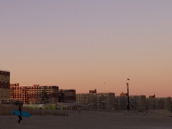
Rockaway Beach in late September. Those large apartment buildings pre-dated the storm and make retreat difficult to contemplate. But some experts say the policy choices forced by climate change will only get harder.
There’s no denying that “managed retreat” is a radical idea. Few politicians have the courage or the capital to float the idea, let alone execute it. And while not unprecedented as a concept—small coastal tribes in Alaska, Washington State and Louisiana have been forced to begin doing it—New York City would present extraordinary challenges of scale. The city’s large and growing population makes relocation hard to contemplate, and the severe affordability crisis that’s already making it difficult for working-class people to survive in the five boroughs renders such shifts downright scary. It’s much nicer to think, as urban dwellers have done in the past, that New York will find a way to outsmart nature.
Indeed, the city is making a bet that its nearly $20 billion investment in new protective measures will buy it time to figure out exactly what a warmer planet has in store and come up with ways to deal with that new reality. It’s a common wager for cities and states located on the coasts. The question is whether our confidence in our ability to have it all—waterfront properties and safe people, resilient neighborhoods and economic diversity—is properly calibrated to the enormous risks posed by climate change.
New York City, you see, is wrestling with a problem that involves more than the weather. With 164 million people living on the coastal United States, and with their numbers growing by 1 million each year, climate change is a challenge not just to engineers and zoning officials, but to the very capacity of democratic governments to plan for the long term—a time when everyone reading this article is dead and the world is a much different place.
In some ways, Sandy was a very abnormal event to alert people to the new normal. It wasn’t even a hurricane by the time it made landfall in New Jersey, but it was still an enormous storm—three times the size of Hurricane Katrina—that struck not just at high tide, but at an unusually high one. The chances of a storm exactly like Sandy ever happening again are low, even with climate change; scientists are careful to note that it’s impossible to link any individual storm to the warming earth. It’s also hard to say whether climate change will translate into a higher number of tropical storms, or fewer but more intense ones.
What is clear is that any storm—including the winter nor’easters that have always posed a more common threat than hurricanes to New York City—has the potential to do much more damage when it travels over higher water. And there is almost no doubt that the seas are going to rise dramatically around the city. Estimates of the extent of that rise have only grown more alarming over time.
When the pioneering New York City Panel on Climate Change reviewed the evidence in 2009, it predicted a rise of seven to 12 inches by the 2050s, and 12 to 23 inches by the 2080s. An update released earlier this year anticipates a rise of 11 to 21 inches by the 2050s, and 18 to 39 inches by the 2080s. By 2100, the mid-range estimate is for a sea-level rise of 22 to 50 inches, but it could be as high as six feet. The predictions translate into a “10- to 15-fold increase in frequency of the current 100-year coastal flood by 2080.” New York City will go from having 400,000 people in its floodplain today to twice that amount—some 800,000 people, over 72 square miles of the city—living within the flood zone. The city has projected that by 2050, a Sandy-scale storm would cause not $19 billion in economic impacts, but $90 billion in today’s dollars.
NASA
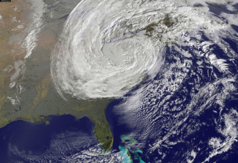
Superstorm Sandy seen from space, October 30, 2012.
Eight months after Sandy, in June 2013, then-Mayor Michael Bloomberg traveled to the Brooklyn waterfront to unveil the Special Initiative for Rebuilding and Resiliency (SIRR), his vision for how the city would manage life on the edge of a rising ocean. Impressive as always when discussing a topic where his command of technical detail was matched by real passion, Bloomberg declared: “We cannot and will not abandon our waterfront. It’s one of our greatest assets. We must protect it, not retreat from it.” There was a “futility” to retreat, the mayor said: In addition to the 400,000 people living within the floodplain, there were businesses employing 270,000 workers. “They are not going anywhere, and we cannot and will not abandon them.”
This was no surprise: As mayor, Bloomberg oversaw a huge transformation of the waterfront—some of it for the enjoyment of the public, but a great deal for the benefit of luxury-condo owners. He wasn’t about to let his legacy be erased. Indeed, the SIRR laid out a massive building plan to protect the city from storm surges. Its $3.7 billion first phase alone includes beach nourishment, drainage systems, levees, new dunes, protective groins to reduce wave velocity, flood walls, surge barriers, wetlands restoration, revetments, bulkheads, and breakwaters.
Vehemently critical of Bloomberg’s legacy, current Mayor Bill de Blasio hasn’t deviated much from his predecessor’s policies on climate change. He’s strengthened the city’s commitment to reducing its carbon footprint. He’s carrying out the SIRR: replacing the Rockaways boardwalk, repairing bulkheads elsewhere on the peninsula, replenishing beaches in Staten Island, and launching a dizzying array of planning studies. And he has steadfastly resisted any discussion of retreat from the areas most at risk.
“When you look at a really dense city like New York—we have 115,000 or so people living on the Rockaways—retreat has huge implications,” says Daniel Zarrilli, the current head of the city’s Office of Resiliency and Recovery. “There are ways to flexibly adapt and invest to reduce those risks to manageable levels, given the risks we see for the foreseeable future.” In fact, he says, the de Blasio administration may even permit denser residential construction in some areas to lure new development, because new buildings constructed to code contain better protections against flooding.
The city’s coastal-protection plan doesn’t purport to give New Yorkers total safety from coastal flooding; it acknowledges that a storm surge can sometimes overcome even the elaborate defenses that the city is building. Zarrilli reminds audiences that there is “no silver bullet” against something as large and unpredictable as the Atlantic Ocean.
Bloomberg’s 2007 PlaNYC—the document laying out the climate-induced threats and potential solutions—was even less sanguine. “We could even consider a storm surge barrier across the Narrows,” the report said, referring to the entrance to New York Harbor between Brooklyn’s south shore and Staten Island’s northeast coast, “but the massive changes that scientists predict under extreme scenarios would still place much of the city underwater—and beyond the reach of any protective measures.”
That’s the problem with a wall, says Klaus Jacob, a Columbia University scholar who sits on the city’s climate-science panel: However high it’s built, someday a wave will be big enough to top it—or to flow up rivers and streams and flood the city from behind. “If you have a fixed height, you feel safe for the next decades—but then what?” Jacob says. “Because you have [only] postponed your problem. You have actually accumulated risk behind the barriers while the barriers lose their defensive capacity.”
Jacob argues that the city should begin planning for “strategic resettlement, strategic relocation, strategic retreat—whatever you want to call it.” Given the likelihood that a sea-level rise could make some neighborhoods (including parts of Staten Island, Brooklyn, and Queens) unlivable within the next century, he believes the city ought to start thinking about how to get people out of there in a way that is fair and orderly, as well as how to avoid putting new residents in the path of future harm.
After all, New York City doesn’t face the life-or-death situation confronted by New Orleans, with 70 percent of its population living in a floodplain, or Fort Lauderdale, where half of the city’s residents are at risk. While the Big Apple has a long coastline, it also has a large inland area, much of which rises well above sea level. That means there are places to put people who can’t live near the water anymore. Sell the development rights to build higher in those areas, Jacob says, “and use the money to buy people out.”
Outside the city, some experts have embraced managed retreat as one of many options governments should employ. An Urban Land Institute task force recommended that local governments identify unplanned areas “to relocate populations and businesses in a manner that allow[s] for social continuity over time with low levels of market disruption.” The Army Corps of Engineers concluded that “improved land use, wise use of floodplains, responsible evacuation planning, and strategic retreat are important and cost-effective actions,” although it noted that retreat would be hard to accomplish in the short term.
Some governments are pulling it off, albeit on a small scale. New Jersey’s Blue Acres program has bought out more than 350 properties in flood-prone communities. New York State has a similar program: It acquires parcels from homeowners who want out and sells them to others who promise to build new properties that are up to code. It also offers buyouts in areas where the risks are obvious and the community is overwhelmingly supportive. In these cases, the state purchases the land, demolishes the houses, and lets nature its course.
The poster child for this effort is Oakwood Beach, a neighborhood built amid marshland on the east coast of Staten Island. During Sandy, the area was a showcase for nature’s power: houses lifted off their foundations or stripped of their roofs, appliances blown across fields of reeds. “There really shouldn’t have been development in this area in the first place,” says Lisa Bova Hiatt, the executive director of the state program called NY Rising.
But alongside the buyout area are houses that have been rebuilt and will remain—a reminder that while Sandy presented a difficult policy question about whether and how to rebuild, it also created a human catastrophe that the city had to address. “Some of the tasks are at cross-purposes with one another,” says Joan Byron, director of policy at the Pratt Center for Community Development. “The moral obligation is to help people go back to where they were. We’re trying to do that and also adapt to the fact that the status quo isn’t what we thought it was.” But at some point the city has to reconcile these two threads: the desire to help victims and the need to plan wisely.
Seth Pinsky, an attorney who led the city’s Economic Development Corporation during the Bloomberg years, headed up the task force that produced the SIRR. The most important thing to understand about the coastal-protection plan, Pinsky says, is that it wasn’t aiming for the year 2100.
“We deliberately chose a time frame that was sufficiently far out that many of the impacts of climate change that were relatively predictable were likely to have been felt by the city,” he says, “but wasn’t so far out that…we would end up being frozen by the magnitude of the challenge we had to overcome.”
Jarrett Murphy
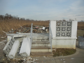
Damage from Superstorm Sandy in the Oakwood Beach area of Staten Island
Part of the city’s thinking in preparing for climate change until only the year 2050 concerns probability. “The error bands get really wide as you go out beyond 2050,” Zarrilli says, and he’s right. There’s a four-inch swing in the midrange estimate of sea-level rise for New York in the 2020s. That becomes 10 inches by the 2050s; by 2100, the midrange spread is more than two feet. And the distance between the low and high estimates for 2100 is five feet. This is one of the quirks of climate-change science: It’s rare to know that a very serious problem is coming so far in advance, and yet so early that we don’t know exactly what it will look like.
Still, even if we knew exactly what was going to happen in 2080 or 2100, it would be impossible to actually prepare for it, Pinsky says. Trying to do so would bust the budget and miss the chance that some new innovation—or, under the worst-case scenario, an even more pressing threat—will come along and change the game. Pinsky describes the city’s approach this way: “Let’s look for a way to buy ourselves time, and then our successors will address the next increment.”
The city calls this a “flexible-adaptation pathway.” “We’re going to do the things that we know we need to do now, sort of the ‘no regrets’ actions, and then continue to make investments,” Zarrilli says.
It sounds like a sensible approach. The problem, according to Jacob, is that it’s hard to say what counts as a “no regrets” action if you don’t know where you’re headed. “You have to have a long-term vision,” he explains. “That doesn’t mean you have to design for 100 years from now, but you have to have that vision.”
Jacob knows it’s asking a lot for a government to look that far into the future. But if it’s difficult to contemplate finding an alternative place to house the current number of waterfront residents, it won’t get any easier if that population continues to increase in the meantime. “Planning for 2500 would be idiotic,” he says. “But [so is] planning for 2050 what we know will not survive 2100.”
New York City’s planning department is conducting a series of neighborhood studies of narrowly defined, low-lying coastal areas like the Bronx’s Harding Park, Manhattan’s West Chelsea, Brooklyn’s Canarsie and Gerritsen Beach, Staten Island’s East Shore, Queens’s Howard Beach, and more. It seems possible that some of the plans that emerge might open the door for managed retreat. For now, those at the most risk from rising seas are divided on whether to contemplate a day when the place they call home no longer exists.
Lawanda Gainey lives in Carleton Manor, one of the public-housing complexes in the Rockaways, where she’s been for 26 years. “Old residents know nothing but the Rockaways…. They do not want to go.” But people in her generation or younger feel less attached. “I think if we had a chance to leave, then we would—no problem.” She feels safer now thanks to the city’s resiliency work, she says, but even so: “Who’s to say that [the next time] won’t be 10 times worse than it was the last time? Who knows?”
A short ride away, in the neighborhood of Broad Channel in the middle of Jamaica Bay, Dan Mundy rattles off all the projects under way to protect his neighborhood: wave attenuators, mini-wetlands, the raising of whole streets. Mundy, a New York City fire chief, has been an environmentalist and advocate for the bay for more than a decade. He and other residents were the ones who figured out years back that plants in the bay were dying because of nitrogen from a city sewage plant. They outsmarted the scientists who had been certain that something else was to blame. The experience has made Mundy—no climate-change denier—skeptical of the experts’ projections.
“I have seen theory after theory fall by the wayside,” he says. “Some predicted that by 2015, we’d see two feet of sea-level rise.” Mundy lives in his grandmother’s house in Broad Channel: Occupied since before 1938, the house took on water for the first time during Sandy. If he knew for sure that the place would someday be unlivable, Mundy says, he would likely stick around and live out his life in a place he loves. But “I certainly would have a different position for my kids.”
The fact is that climate change will deliver a slew of new risks and problems, storm surges being just one. Few people will escape blackouts, food shortages, and the other greenhouse-effect nightmares that await no matter how far they live from the beach. What’s more, cities often depend on herculean efforts to counter the influence of nature. Chicago lifted itself two feet to escape the grime of lakefront life, and it reversed the course of its river so that it didn’t drink its own sewage. The Greater Los Angeles Area barely had water for 100,000 people; engineering has allowed it to house more than 18 million. Much of Boston is landfill, and New York flooded whole towns to make reservoirs for its millions. “We’ve transformed environments in ways people probably never would have imagined,” says William Solecki, a social scientist who co-chairs the city’s climate-science panel. Maybe New York will figure out a way to live with dramatically higher water levels, too.
Or maybe not. The essence of climate change is that it’s unlike any threat human society has encountered before. In the face of such danger, overconfidence in our problem-solving capacity could magnify the risk.
“Is it possible that parts of the Rockaways won’t exist in 2100? Absolutely,” says City Councilman Donovan Richards. “These are all things the city has to grapple with. So yes, I think it’s very clear that if we don’t get serious, if the world doesn’t get serious, we will see—in Queens, on Staten Island, in Brooklyn—communities wiped off the map. I think it’s very clear that we are in imminent danger.”





3 thoughts on “Sandy+3: NYC Not Pulling Back from the Water’s Edge”
I don’t have a problem with rich and working class families that are willing to assume the risk of being emotionally and financially wiped out due to coastal hurricane damage. As a taxpayer, however, I DO object to having to share any financial risk with those coastline people who are willfully ignorant of the inevitable climate catastrophe that awaits – far sooner than 2050.
I have a REAL problem with developers looking to profit from projects in flood-prone areas, developers benefiting from all manner of economic incentives, including sweetheart financing for both the construction phase and marketing phases, who then sell their completed projects to families who will ultimately require extensive tax-funded support… let’s nip this in the bud!
If, or when, everything melts, most of NYC will be below the waves, with only small bits, like Grimes Hill on Staten Island, Washington Heights, and the northern Bronx, sticking out of the sea. All of Long Island will be gone. And Grimes Hill, the tallest point on the East Coast north of North Carolina, will be an island miles off the coast.