Share This Article
The city’s only freshwater river would receive $111 million of work to reduce the impact of sewage overflows and could be designated for more intense recreational use under a plan prepared by the Department of Environmental Protection.
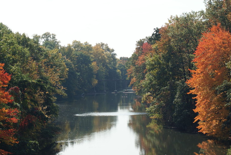
The “long-term control plan” for the Bronx River was submitted late last month to state environmental regulators. It is the fifth in a set of 11 DEP is preparing to comply with federal laws requiring better control of combined sewer overflows, or CSOs.
Half of New York City’s land area is served by older sewers that combine wastewater from bathrooms and kitchens with rainwater from street drains. When it rains heavily, the volume of water overwhelms treatment plants, and billions of gallons of untreated stuff gets released into rivers and bays.
The introduction of fecal bacteria and other contaminants make some city waterways unsafe to fish, boat or swim in, putting them out of step with the Clean Water Act’s requirement that all water be open to recreation. New York City lags some other cities in dealing with CSOs and is now trying to comply with a consent order that has been revised several times since the late 1990s.
DEP spent months sampling water at points along the Bronx River from the Westchester County border to the East River, measuring the amount of fecal bacteria—which is bad for people—and dissolved oxygen, which is good for fish. Then the agency evaluated a range of alternatives for dealing with CSOs, like creating big tunnels to hold the sewage water for treatment or disinfection stations to add chlorine to the releases to kill bacteria. The cost of those options ranged from $41 million to $701 million.
The agency selected the fourth most expensive plan, priced at $111 million. This will involve building pipes to take water that would have been released at two upstream CSO outfall pipes and send it to a different outfall that empties into the East River, where any contaminants are more likely to be diluted.
The Bronx River is composed of salt water up to Tremont Avenue and freshwater above that. CSOs only affect the salt water part. That area is right now designated as Class I, meaning only secondary contact—not fishing or swimming—are advised. The DEP says the river already meets water quality standards for Class I. Under the proposed plan, the agency says the saline part of the river could be upgraded to a category that’s appropriate for fishing.
Water quality standards are evolving, however, and DEP says that even with 100 percent control of CSO pollution, the Bronx River can’t meet those standards. In fact, the agency notes that pollution in the river “appears to be more affected by bacteria loads from the East River, which enter on the incoming tide, as well as upstream bacteria loads that tend to linger through multiple tidal cycles.”
In other words, CSOs get the ink, but they’re not the heart of the matter when it comes to Bronx River pollution.
In fact, water quality in the Bronx River is worse in the freshwater areas where there are no CSOs. There the pollution comes downstream from Westchester County or into the river when stormwater flows in from its banks. Cope Lake, which empties from the Bronx Zoo into the river, is a big source of nasty stuff, according to DEP.

Dealing with stormwater—not CSOs—is the next big puzzle for the city to solve. The state and city are currently negotiating regulations to cover stormwater. In its Bronx River report, DEP promised to take “a more holistic approach to this watershed, recognizing that opportunities exist for greening and stormwater management throughout the freshwater portion of the Bronx River. ”
DEP has previously submitted CSO control plans for Alley Creek and Flushing Creek in Queens and Westchester Creek and the Hutchinson River in the Bronx. The agency put forward the plan for Gowanus Canal in Brooklyn late last month along with its Bronx River proposal. Plans for Coney Island Creek and Flushing Bay are due next year. In 2017, DEP is scheduled to finish up with submissions covering Jamaica Bay and Newtown Creek and a citywide strategy.
The process has been contentious. The state rejected two versions of the plan for Alley Creek, leading the city to file a lawsuit claiming Albany was being unreasonable in its demands on the city. The case is still pending.
2 Comments