Beyond My Ken
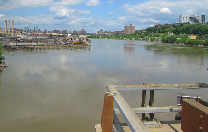
The Harlem River north of the University Heights Bridge. New building on the Bronx shoreline to the right, could follow development on the Manhattan side.
Big plans are nothing new along the Harlem River. Its original course from the Hudson to the East River took a crescent course around the Manhattan neighborhood of Marble Hill. But in the late 1800s, engineers cut a shipping canal to bypass that bend, a move that turned Marble Hill into an island surrounded by river. A few years later, the original river curve was filled in, and Marble Hill—to this day legally part of Manhattan—became part of the Bronx mainland.
If a vision detailed in a new report comes to fruition, there’ll be big plans again for the Harlem River—involving not the water itself, but the land on its east side where the Bronx dramatically descends to the river’s edge. In a study commissioned by the Department of City Planning, the Urban Land Institute (ULI) saw potential for recreation and mixed-use development on the Bronx coast immediately north and south of the University Heights Bridge, which connects Manhattan’s 207th Street and Fordham Road in the Bronx.
Right now the area is used by industrial companies and public entities like the MTA, partly because that’s the way it’s zoned. But even where the zoning would allow different uses, development is hindered by the Major Deegan Expressway and Metro-North tracks limiting linkages to the Bronx street system.
There’s potential for something more, ULI argues. The area offers waterfront views, connections to interesting neighborhoods and good access to the bus system and the Metro-North line.
The way to tap into that is to think of the Bronx and Manhattan sides of the Harlem “as one cohesive community connected by a common waterway, rather than separated by it” and branding it “the people’s river.”
Right now, the report recommends the city create open space and a marina to permit recreational use of the Harlem by boaters, canoeists and kayakers. That will start building a constituency for the area.
Then, after redevelopment of the Manhattan side takes off, there are two paths the city could follow. The easier one is rezoning the parcels near the water for residential development and improving access to the area from the street system. The harder option? Building a massive deck over the Deegan to permit even more development. Under either scenario, ULI writes, a significant public investment would be needed to create the access and amenities that would make the development viable.
Read the report below and let us know what you think of the idea.