Legacy: The Preservation of Wilderness in New York City Parks, at the Museum of the City of New York, Tuesday through Sunday 10 a.m. – 5 p.m., adults $10, through March 21.
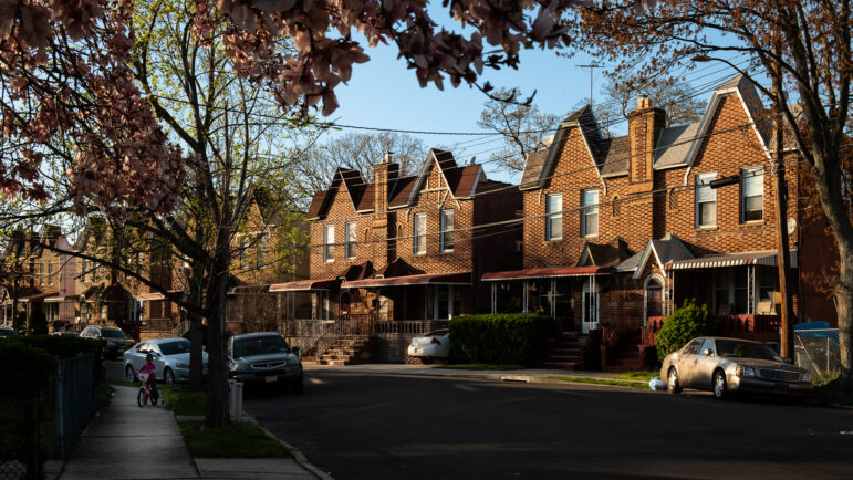
New York City: The images are endless. Teeming streets, skyscraper canyons, walk-up tenements, noisy playgrounds, dizzying signage, honking traffic, varied architecture. It all adds up to the pulsating, unrelentingly man-made surroundings that enthrall locals and visitors alike.
But pastoral sanctuaries? Rugged terrain? Pristine wilderness? Forests so dense no sound or view of the city interrupts … natural outposts undisturbed since Native Americans trapped animals … protected refuges for fox, rare birds, deer, wild turkey, coyotes and even a solitary beaver in the Bronx River? It’s hard to believe that these wild features, too, are part of our metropolis.
Yet, practically half of the city’s 29,000 acres of park land – a full 12,000 acres – is just that: salt marshes, forests, lakes, meadows, beaches and wetlands, rarely happened upon by any but the most intrepid city dwellers. Who knew?
The photographic exhibit “Legacy: The Preservation of Wilderness in New York City Parks,” opens the eyes of even the most seasoned urbanists to a side of the city rarely seen. With a rich variety of magnificent pictures – some as big as a whole wall – of 50 parks made by photographer Joel Meyerowitz (who is known, among other things, for his work documenting the aftermath of the Sept. 11 attack), the exhibit introduces viewers to the largely unknown patches of unblemished nature generously sprinkled throughout the four corners of the city. So much of it is accessible that the opportunities seem limitless to experience nature in the wild right here in New York City, opportunities so many New Yorkers are unaware of.
The show’s 90 images are only a fraction of the 3,000-image archive created by an unusual commission to survey the city’s parklands, from the highly used to those hidden in plain sight. The brainchild of Parks Commissioner Adrian Benepe, this is actually the first such survey done since the 1930s.
The exhibit begins in the Bronx, where Meyerowitz grew up in the 1940s and 50s. The northernmost borough also has the greatest proportion of parks, covering about a quarter of the land area. Meyerowitz surprises by not telling the usual stickball-on-asphalt tales of urban childhood, but rather describing in the exhibit’s accompanying book a youthful experience seemingly more suited to a Tennessee child:
“I played Huck Finn with my friends on a tributary of the Bronx River in what is now the Soundview area. Using builder’s planks and other leftover wood scavenged from the local markets, we once constructed a raft that we strung together with baling wire and rope. We then poled and carried it, over three successive days, from about where the Bruckner Expressway now crosses Soundview Avenue all the way to its outlet between the end of the East River and the Long Island Sound.”
Today, canoes ply the river instead of rafts, since it has been incrementally cleaned up since the 1970s, but both transport experiences – raft or canoe – seem so unlikely in this most concrete of concrete jungles. But one can imagine a more Daniel Boone-like adventure with a glance at a bucolic summer view of the deep woods of Twin Island in Pelham Bay Park, or at a rock outcropping in springtime along the Cass Gallagher Nature Trail in Van Cortlandt Park, the city’s third-largest. And one can imagine getting totally lost deep in the woods of Wolfe’s Pond Park in Staten Island’s Greenbelt or enjoying a summer “staycation” at any stretch of the city’s miles of beachfront.
~
Some of the images are just stunning in their arresting beauty. A series of 15 small photographs of Hallett Nature Preserve, year round, not far from Wollman Rink in Central Park, include a glistening winter snow scene, a view with a lightning bolt in the distance, and a mysterious one with a cluster of balloons landed in the middle of a thicket of trees. The “silver silence” in Staten Island’s High Rock Park created by the mist and rain, reminiscent of a Dixie bayou, at the far southern end of the city looks like an Impressionist painting. The sheer gorgeousness of some of these views is worth a visit to the exhibit, if not to discover a side of the city so little known.
Others of Meyerowitz’ images help you see even the familiar in a new light: A winter view of Literary Walk in Central Park, with not a leaf in sight, somehow transforms this often pedestrian-crowded destination the feeling of a dense forest. Many images are arresting because Meyerowitz has the uncanny ability to find the poetic majesty in a simple landscape. And he has found it throughout the city.
The more typically urban view of peopled places has not been overlooked, however. A yoga class is shown enjoying a peaceful edge of Fort Greene Park. People relax under a glorious stand of trees in Sunset Park with the residential neighborhood and city skyline behind them. A group enjoys sitting near a pier on the water’s edge of Brooklyn’s Louis Valentino, Jr. Park and Pier. And scattered throughout are images of the varied settings at whose edges the skyline looms.
What this exhibit actually reflects is the little-known, multi-decade transformation of both the familiar and unfamiliar city parks, the wild and the designed, the well-used and the unknown, started under commissioners Gordon Davis and Henry Stern in the 1980s and enthusiastically continued under the current parks chief, Adrian Benepe. Individual park administrators have been installed. Major clean-ups have occurred all over, often started by local groups or larger nonprofits with the Parks Department coming in as a partner. The detritus of tires and mattresses that once filled places like the Bronx River are gone. Protective railings have been installed, invasive species weeded out, new deciduous and conifer trees gradually planted, and the diversity of native plant life restored – all in preparation for eventual park development as funds become available. The era of neglect and decay of the 1960s and 70s is a distant memory, as it is in many of the once-shabby neighborhoods adjacent to some of these parks.
As Benepe traveled around these known and unknown areas, he realized how useful a survey would be and sought out Meyerowitz who “understood landscapes and people in landscapes” so well. Now they have an archive that will eventually be on the Parks Department website. Since all shots are GPS-coded with time and date, “we will know how nature is functioning in the urban environment,” Benepe explains.
If global change does unforeseen damage, we will know it. Perhaps, another survey in 10 years – and a subsequent exhibit – will tell us as much as this one does now. Let’s hope the news will be good.
Urbanist Roberta Brandes Gratz is a founder of the Center for the Living City and author of the book “The Battle For Gotham: New York in the Shadow of Robert Moses and Jane Jacobs,” to be published next month.